Roman River Valley Wildside Walk - Healthy Life Essex
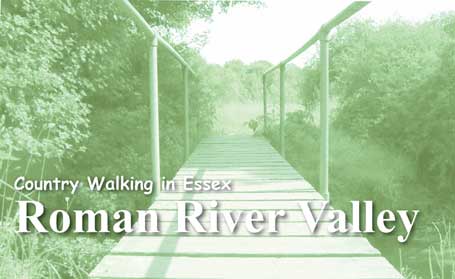
Take time to explore the rolling countryside of the Roman River Valley and
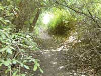
enjoy the wildlife of the wooded streams and marshland. The woodlands you walk through are mostly ancient and Bluebells and Yellow Archangel can be seen flowering in the spring. Look out for the globular white flowers of Small Teasel in late summer, but most of all, make sure you bring a wildflower identification book!
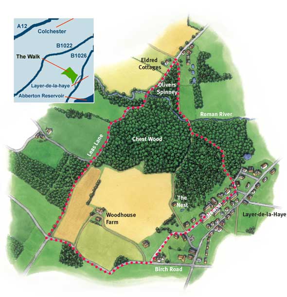
The Roman River Valley Nature Reserve
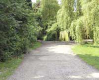
 This Essex Wildlife Trust Reserve is a fragment of traditional river valley landscape, part of the Roman River Valley Conservation Zone. The historic Roman River is a narrow stream through most of the Reserve and meanders through marsh and woodland, mostly old.
The marshy areas found on the area are fed by springs filtering out of glacial gravels, and is full of aquatic plants including one that is unusual – the Small Teasel, which has globular white flowers in late summer. The woodland is part of Needles Eye Wood, and has a variety of trees including standard Oaks, Coppiced Hornbeam and several old Yews. Its flowering plants include Yellow Archangel and Moschatel. Like most wetland sites it has a rich insect life as well..
Follow the Waymarks ............... click here
Wildside W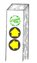 alks are usually ‘Waymarked’, but be aware that some waymarks are now in dis-repair or even missing. They are found on special posts, stiles, gates and some fingerposts. The posts are usually painted white so that they can be seen from a distance (when needing to cross large fields etc this can be very useful. Tip: Binoculars can be handy to have when looking for the white posts.)
alks are usually ‘Waymarked’, but be aware that some waymarks are now in dis-repair or even missing. They are found on special posts, stiles, gates and some fingerposts. The posts are usually painted white so that they can be seen from a distance (when needing to cross large fields etc this can be very useful. Tip: Binoculars can be handy to have when looking for the white posts.)
Wildside walk plaques are bright green and unique to Wildside walks in Essex.
Yellow ‘Directional Arrows’ usually on circular disks indicate the direction you should follow. (Path junctions are more complicated! Each arrow indicates an alternative route, so use the map to make your choice.)
Three different types of directional arrow are used:
Plain Yellow: used on ‘official’ public footpaths
Yellow Arrow with Courtesy Footpath: A small number of paths are not ‘official’ public rights of way. Most courtesy paths are in Nature Reserves and are generally provided courtesy of the landowner.
Plain Blue: Used on ‘official’ bridleways. Only found on the Bicknacre walk – look out for horses and cyclists.
| Open a larger scale, printable copy of this map in Adobe pdf format |
|
Points of interest along the way
Crab Apple
 As you wander along Leas Lane look out for Crab Apples in the hedgerow in late summer. These small fruits are extremely sour and Crab Apple wine is reported to be potent. You have been warned!
Dragonflies
The Roman River supports many dragonfly species including the iridescent Banded and Beautiful Demoiselles. Males of the Banded Demoiselle can often be seen aggressively defending their territories or courting females with a fluttering display flight. The luxuriant vegetation along the Roman River is extremely important for dragonflies, for instance, submerged plants may be used for egg-laying. Many species of dragonfly are also important indicators of clean water. The Emperor, Britain’s largest dragonfly is particularly sensitive to water pollution and can be seen along the clean water of the Roman River..
 Dog’s Mercury
Under the dense canopy of the woodland you may find Dog’s Mercury, a sombre green plant with square stems and unobtrusive yellowish green flowers. The plant is dioecious which means that the male and female flowers are on separate plants. The whole plant is considered mildly poisonous, particularly at the time of fruit ripening; however there are no reports of poisoning in humans. Wash your hands if you touch this plant to be on the safe side!.
Layer-de-la-Haye
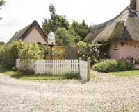 Layer, as it’s known locally, is thought to have been founded in Saxon times, with its original name, Legra, meaning ‘lookout’. The elevation of Layer made it an ideal vantage point for the Saxons in spotting raiding parties from the Essex coast. Its name changed to Leire or Leger in later years which means ‘mud’. Leger is a Norse word, which is likely to have referred to the marshland surrounding the settlement..
Otters
The otter was quite common in Essex in the 1940s and 50s but suffered a rapid decline in numbers in the 1960s and unfortunately became extinct in the 1970s due to the poisoning from agricultural chemicals which ran off into the rivers and streams from surrounding farmland. However, the otter has since recolonised many of its old Essex haunts..
|
Distance and time taken Going Transport Habitat types |
Ordnance Survey Map Parking Refreshments Dogs |
Photographs Courtesy of Public Rights of Way Dept, Essex County Council
![]() Produced in conjunction with Essex County Council
Produced in conjunction with Essex County Council
Maps reproduced by kind permission of
the Public Rights of Way Dept, Essex County Council
www.essexcc.gov.uk/prow