Cudmore Grove Wildside Walk - Healthy Life Essex
Home » Articles » Outdoor Life » Countryside in Essex » Country Walking » Cudmore Grove Wildside Walk
Blow away those cobwebs with an exhilarating day at the coast.
Cudmore Grove Country Park
Cudmore Grove covers an area of 38 acres and is owned and managed by Essex County Council. It was designated a Country Park in 1975 and is now managed for wildlife and informal recreation. The site comprises an area of grassland; a cliff top grove of oak trees and a small sandy beach…so don’t forget your bucket and spade!
 Prior to 1975 the site was an area of farmland bordered by elm trees. The elm was the dominant tree on Mersea Island but in recent years Dutch Elm Disease has claimed many victims. New trees have been planted to try and restore the balance.
East Mersea is a ‘Twitcher’s Paradise’. Most of the mudflats and saltmarsh surrounding it belong to the Colne Estuary National Nature Reserve and these provide important breeding grounds for many species of bird. Take your binoculars and see how many different types of bird you can spot.
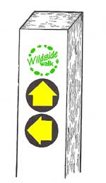 Walks are usually ‘Waymarked’, but be aware that some waymarks are now in dis-repair or even missing. They are found on special posts, stiles, gates and some fingerposts. The posts are usually painted white so that they can be seen from a distance (when needing to cross large fields etc this can be very useful. Tip: Binoculars can be handy to have when looking for the white posts.)
Wildside walk plaques are bright green and unique to Wildside walks in Essex.
Yellow ‘Directional Arrows’ usually on circular disks indicate the direction you should follow. (Path junctions are more complicated! Each arrow indicates an alternative route, so use the map to make your choice.)
Three different types of directional arrow are used:
Plain Yellow: used on ‘official’ public footpaths
Yellow Arrow with Courtesy Footpath: A small number of paths are not ‘official’ public rights of way. Most courtesy paths are in Nature Reserves and are generally provided courtesy of the landowner.
Plain Blue: Used on ‘official’ bridleways. Only found on the Bicknacre walk – look out for horses and cyclists.
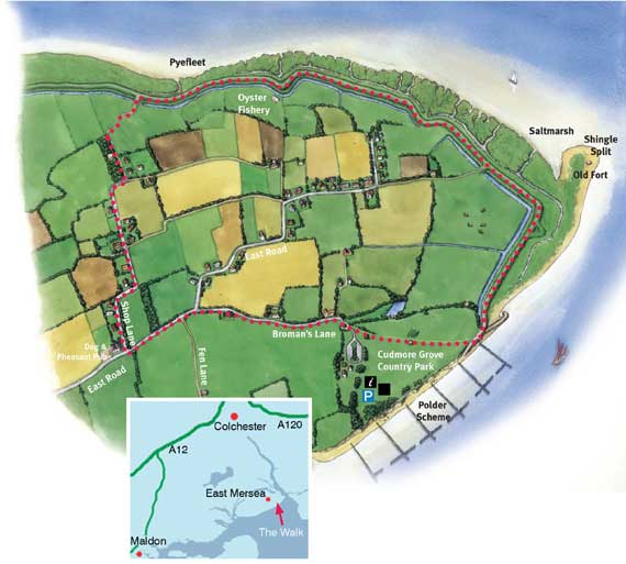
| Open a larger scale, printable copy of this map in Adobe pdf format |
 |
 |
 |
 |
 |
|
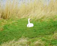
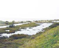
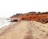
Images of Cudmore Grove
|
Points of interest along the way
Colchester oyster fishery
This is the main centre for oyster fishing in the Colchester area. Mersea Island has a tradition of farming oysters since Roman times. In recent years there has been a decline due to a variety of adverse environmental factors.
Pyefleet Channel
This Channel separates Mersea Island from the mainland to the north. On the north side of the Pyefleet is Langenhoe Marsh. This is an extensive army firing range so keep your head down!
View across the Colne
Looking across the River Colne to Brightlingsea you will see many different types of boats including the majestic Thames Sailing Barges and large cargo vessels. The Colne is one of the busiest waterways in East Anglia with many ships importing timber, coal, fishmeal and soya from our European neighbours.
Old Fort
The faint remains of an old blockhouse are just visible behind the sea wall. This was built in 1547 to guard the Colne and saw action in 1648 when it was used to starve the Royalists in Colchester for 70 days. After the Civil War it fell into ruins.
Old bones
Erosion of the cliff has exposed sand and gravels which were laid down by the River Thames nearly 300,000 years ago. Bones dating to the same period showed that monkey, bison, beaver, wolf and bear used to live in East Mersea. The cliff is a geological Site of Special Scientific Interest (SSSI).
Polder scheme
A polder scheme has been constructed on the mudflats using brushwood breakwaters. These will hopefully trap sediment floating in the sea. Once this sediment settles, salt marsh vegetation will colonise on the raised mud and thereby slow the force of the waves hitting the cliff and beach. This will hopefully slow down the process of erosion.
Brent Geese
These fields are managed by Essex County Council as a safe area for Brent geese to graze in the winter. This is to discourage them from grazing neighbouring crops. Cattle usually graze the field during the summer.
|
Distance and time taken Going Transport Habitat types |
Ordnance Survey Map Parking Refreshments Dogs |
Photographs Courtesy of Public Rights of Way Dept, Essex County Council
![]() Produced in conjunction with Essex County Council
Produced in conjunction with Essex County Council
Maps reproduced by kind permission of
the Public Rights of Way Dept, Essex County Council
www.essexcc.gov.uk/prow

